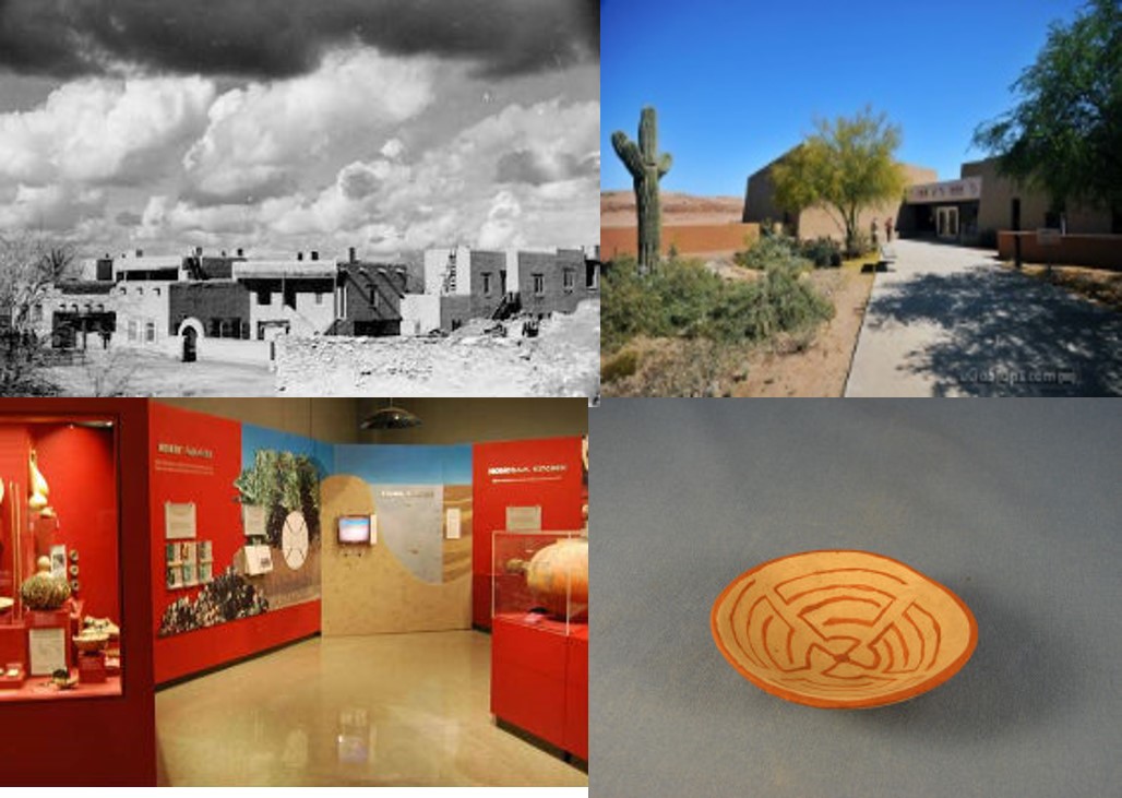
  Pueblo Grande is Prehistoric Phoenix  Golden Poppies, San Carlos 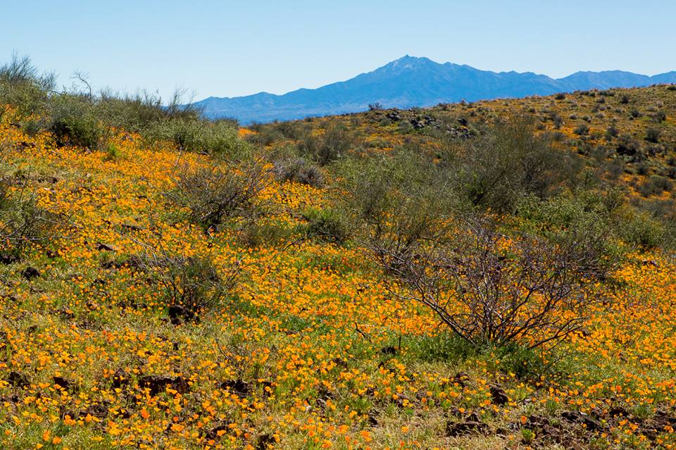 Mt. Turnbull looms over poppy fields 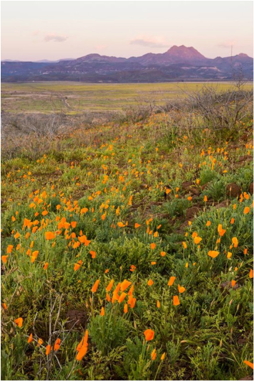 The Triplets in background 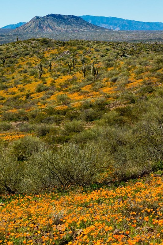 Poppies, saguaros, Bucket Mtn, Pinals 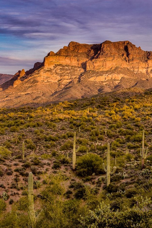 Picketpost Mountain | (Click on blue text to link to details) Next Wednesday, March 2, I will be making a presentation “Weaving Arizona’s Cultural and Natural History into a Mystery,” at the Pueblo Grande Museum in Phoenix. Pueblo Grande is a large Hohokam pueblo which is partially excavated, with on-going archaeological work, restored or reconstructed structures, and a demonstration native garden. In addition to the archaeological park, the museum contains three exhibit galleries, lecture hall and meeting rooms, and a large Museum Store. My presentation will discuss my personal experiences and research on the Apache and other native tribes, past and present that are part of my books. The Museum Store carries all three of my books and I will be signing them following the presentation. Scenic Shots by Kenneth Chan Photography The San Carlos Apache Indian Reservation in East Central Arizona is the home of my character Sergeant Al Victor of the San Carlos Tribal Police. Mount Turnbull, The Triplets, and the Pinal Mountains just west of the reservation are prominently mentioned reservation landmarks in my books. Globe photographer Kenneth Chan recently took a trip to the reservation to photograph the desert abloom with golden poppies, capturing these landmarks in the background. You can see more of his excellent Eastern Arizona Landscapes, and much more, on his Facebook page The top photo is a close-up of golden poppies, prolific numbers of these plants cover our deserts following a wet winter. There are many other desert blossoms that spring up from the moistened ground, but few can rival the poppies for the sheer number of blossoms. Mount Turnbull, in the Santa Teresa Range sits in the Southeast corner of the Sans Carlos Reservation, not far from Aravaipa Creek. The desert foothills are covered with millions of poppies. This mountain is mentioned in all my books. In the Wham Curse Bren describes an overnight hike when hew was a boy scout to the top of the Mountain. Al discusses the Apache belief in the Ga'an as part of the conversation. Bylas, where the San Carlos Police substation and Al's home are located, is near the foothills of Mt. Turnbull. Next is The Triplets, a three peaked mountain very near and northeast of San Carlos, the seat of government of the reservation. It has special meaning to tribal members as a symbol of their homeland. Since these pictures were taken in January much of the brush such as mesquite, greasewood, and palo verde at slightly higher elevation have not yet put on leaves, in spite of temperatures in the eighties. The photo with Bucket Mountain and the Pinal Mountains is on the western side of the reservation just off Highway 70 between Peridot and Cutter. Peridot is one of the higher population centers, sort of a suburb of San Carlos. Cutter is the location of Globe/San Carlos Tribal Airport and the Apache Gold Casino. The photo is taken looking west about five miles from Peridot. I don't believe I've mentioned Bucket Mountain in any of the books. The Pinal Mountain Range abuts into the Mescal Mountains and the reservation western boundary runs near the junction of those two ranges. I believe the Pinals are mentioned in all of my books, and The Baleful Owl is centered in the Western Pinal Mountains near Superior. The southern end of the range includes the tallest peaks; Pinal, Signal, East, and Madera, But the range goes west to the escarpment called Apache Leap and continues all the way to Salt River in the north. The Pinals were a barrier to travel between Globe and the Phoenix-Mesa area until Highway 60 was completed through the range in 1922, ending Globe's isolation. The road passes by Mt. Picketpost west of Superior; a feature mentioned in The Baleful Owl. Known to the O'Odham people as Flat Top Spotted Mountain. To see my books follow the links: The Baleful Owl (2015) Saints & Sinners (2014) The Wham Curse (2012)  |
|
0 Comments
Leave a Reply. |
AuthorMystery writer, Southwestern Historian, researcher, husband, father, grandpa, with an opinion on everything. Archives
October 2021
Categories
All
|
 RSS Feed